The Waratah track is an unformed track that takes you on an alternate route up the Great Western Tiers / Kooparoona Niara to the Central Plateau.
It’s not well known, nor is it advertised to the public; there are no signs telling you ‘here it is’. You gotta find it yourself. It’s something that local bushwalkers love and keep privy to themselves. They don’t want just anyone finding it and with good reason. If you’re lucky, you’ll be invited to experience it and it will become a favourite very quickly.

The stillness of the rainforest
The Waratah track is so named because it showcases the beauty of the native Tasmanian waratah flower which blossoms around this time of year up at high altitude. To see these beauties, you need to start off on the official Parsons Track until you know where to take off. Once you are off the main track and on the wild Waratah trail, you can expect to bushbash for about three hours 800-900 metres straight up.

Bushbashing our way through
The vegetation is very thick in some parts and therefore it’s very easy to get lost, so you have to keep your eyes peeled for the random pink or orange tape attached to branches. The first part of the track takes you past ferns, creeks, and rainforest. It is pretty much an obstacle course from the word go with a neverending supply of fallen logs and branches to navigate.

The rust and golden colour of hard fern new growth before they mature and turn green
Once you are past the first hurdle, then comes the next: negotiating the steepness, while looking for the next pink or orange tape, which may take about 15 minutes to locate. There are sections where the ground is so thickly covered in hard ferns (and the odd leech), that you can’t really see what you’re about to step on. You may have to crawl under or over a fallen log. Snakes could be an issue but they weren’t a concern today. The only potential danger is the odd flying branch tossed your way by someone in your hiking party. 😂🙃

Stupendous view of the Tiers as you hike upwards.
As you follow the unique Tiers landscape, which alternates between steep and flat sections, you zigzag your way up to the eucalypts and waratahs that start to dominate the landscape. It’s here where you’ll stop and look around in awe and wonder at the beautiful red flowers everywhere. Some in your face, others high above you. There’s also a treat to be had here by licking the waratah stamens and tasting its sweet nectar. Don’t forget to listen - to the stillness and the birds twittering and flittering around you.

The beautiful Tasmanian waratah in flower.
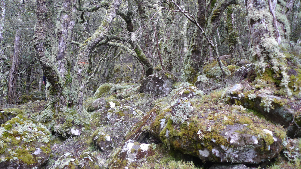
The final section of the hike takes you over a brilliant green carpet of moss and lichen, some of which looks like coral and lettuce. This part is an enchanted forest with massive boulders and hideaways for wombats and trolls.

Enchanted forest.

Waiting for the pathfinders to find the way forward
Soon you come to an area where there is minimal tape, just rock cairns, and eventually the odd sun-faded tape so miniscule it’s a real test just to locate one. This is the point where you let the pathfinders go on ahead and scramble around until they find the way forward, while you sit back and relax.

Navigating the scree to the top of the plateau
Fortunately, you’re almost at the end, with the top in sight as the vegetation shrinks and opens up, and splendid views over the valley and across the bluffs mesmerise you. Through the forest you see the edge bordered by exposed scree and find the path that takes you the last few metres to the top of the plateau.

Lunch time on the plateau with the clag coming in
A well deserved lunch break can be taken here, as you watch the clag or low fog/cloud roll in. If you’re lucky, next time the weather will be amazing and you will see all the way to Bass Strait. Something you do notice though in the low cloud is the temperature at 1200 metres above sea level is vastly different than it was down in the thick humidity of the rainforest.

Crossing the plateau with Cradle Mountain in the background
As you consider whether the clag will set in straight away, you realise the group has enough time to hike the one kilometre across the plateau to the trailhead of Parsons Track. Walking on the plateau takes you past the skeletal remains of bushes, trees and cushion plant carcasses devastated by past bush fires. A few light coloured wallabies bounce around and the amazing skyline of Cradle Mountain’s peaks on the western horizon reveal themselves.

Scoparia making a comeback (bottom) with pineapple grass (top)

Mountain rocket
With delight you spot some scoparia making a comeback, as well as some mountain rocket. The hike back down the Tiers takes you to Haberles Hut.

Almost at Parsons Track trailhead with Mt Roland and Gog Range in background.

Flowering snow gum which only happens every two years
Along the way there’s a tasty morsel to eat - the fungi that grows on the myrtle beech tree. They grow as clumps and sometimes when the cockies are mucking around high in the canopy, they throw them down onto the ground and you can just pick them up. They taste like mushroom and can be eaten when young or mature.

Myrtle beech fungi

Moss carpeting the path to Haberles Hut
There’s a quick stop at Haberles Hut for a photoshoot and then the final descent past a particularly steep section and a small pocket of King Billy pines.

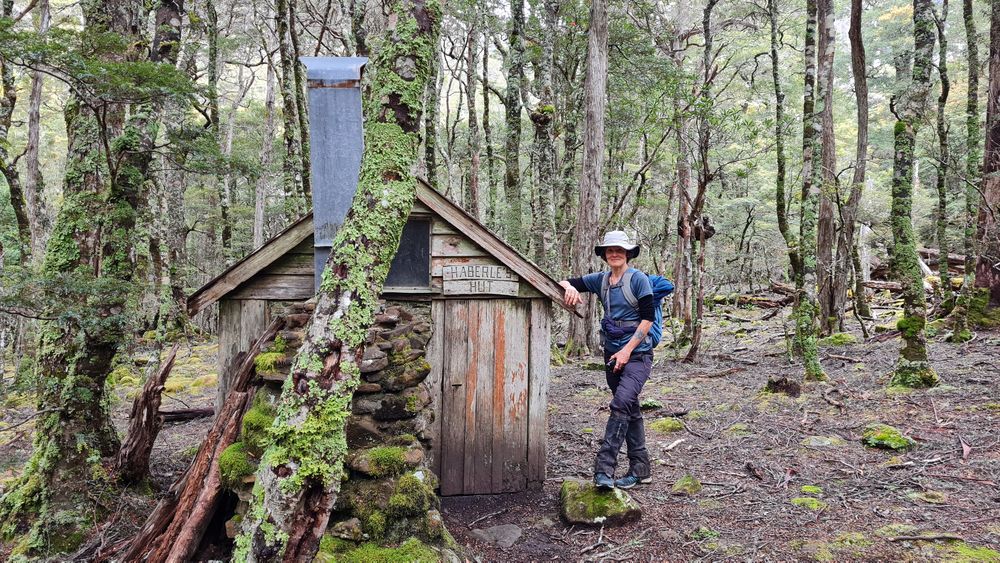
Haberles Hut, built by Mr Haberle for trapping possums during winter

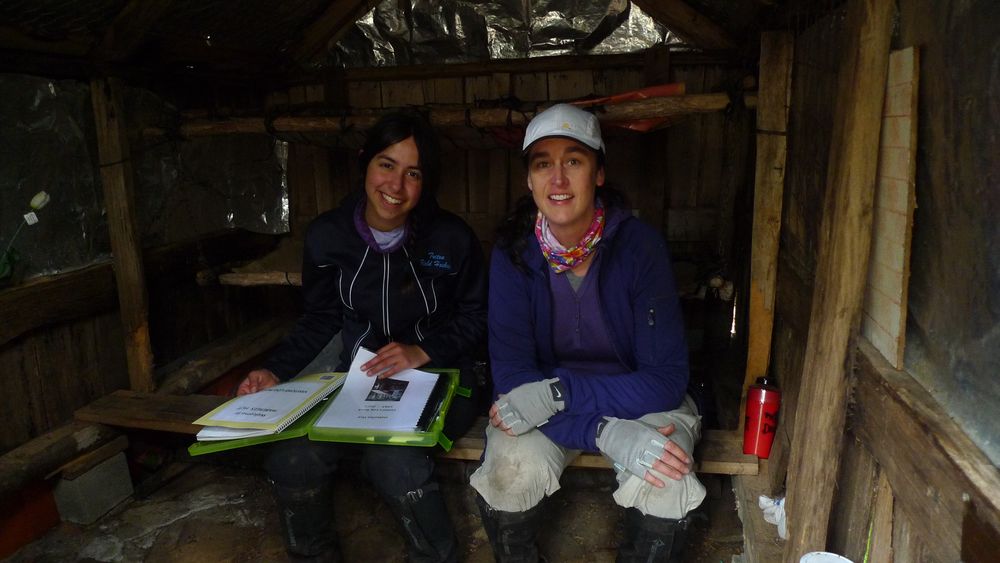
Juli and Sarah inside Haberles Hut

Posing outside Haberles Hut.

Happy hikers
Eventually you find yourself back on the logging road which you started out on almost nine hours ago. Back at the carpark, you look up at the Tiers and find the clag has moved in for the night and feel grateful for the most memorable hike, knowing that you will only be a handful of people who ever gets to hike the Waratah Track.
